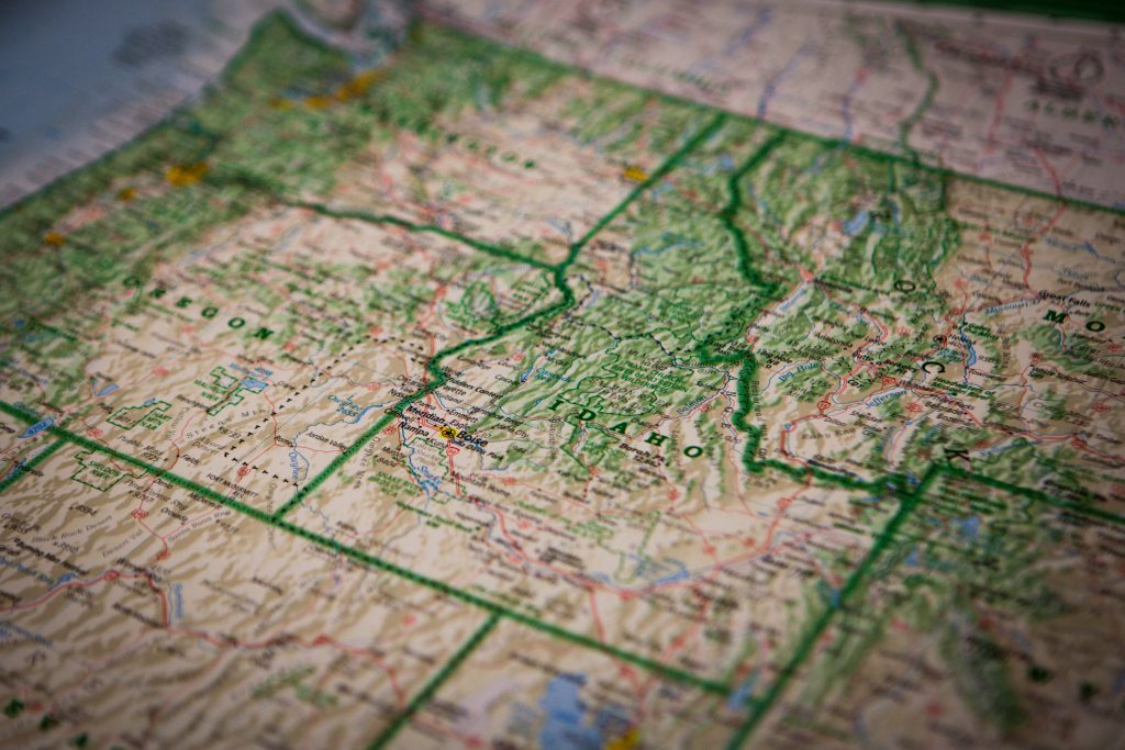
Tucked between Washington and Oregon on the west and Montana and Wyoming on the east, Idaho is the thirteenth largest state in the U.S. And while you may think of it as the state of spuds, it’s really known as the Gem State, since it’s home to 72 types of precious and semi-precious stones.
It’s also home to six of America’s Byways, including the International Selkirk Loop, which it shares with Washington State. (For a national map of America’s byways, go here.)
Idaho has seven regions over its 83,557 square miles, with verdant forests, amazing wildlife, mountain peaks, national reserves, hot springs, and high deserts. And with six America’s Byways to choose from, you will be able to view all the Gem State has to offer. (A comprehensive list of all of Idaho’s scenic and backcountry byways is available here.)
Note: Before heading to Idaho, check this page for the latest coronavirus updates, since there may be travel restrictions in place. Also, know what the health guidelines are in the various locales and bring along plenty of PPE (personal protective equipment), including masks.
Northwest Passage Scenic Byway
At 202 miles, Northwest Passage Scenic Byway (formerly called the Clearwater Canyons Scenic Byway) is Idaho’s longest byway, located equidistant between Boise, ID, Spokane, WA, and Missoula, MT. While it can take six hours to travel the entire byway, you might want to spend several days making the journey, the better to enjoy the sparkling rivers, deep canyons, and rugged mountains.
Some driving tips to keep in mind, courtesy of VisitIdaho.org: Both Idaho 13 and U.S. 12 are winding, two-lane, paved roads with occasional passing lanes and slow vehicle turnouts. If you’re planning to visit during the winter months, road conditions may include black ice in the canyons and snow-covered roads at higher elevations.
Other Scenic Drives in the State
Payette River Scenic Byway
The Payette River Scenic Byway is 112 miles long, with views that include foothills, mountain valleys, canyons, forests, and wide-open valleys. The north-to-south drive on the state’s west side takes less than three hours, although, with so much to see, you’d be wise to allow two days to enjoy it all, including Lake Cascade, Payette Lake, and the Boise and Payette National Forests. Looking for outdoor activities? The byway also offers easy access to rafting, kayaking, camping, and fishing. In terms of road conditions, the byway is a narrow, winding, two-lane paved road with occasional passing lanes and slow vehicle turnouts.
Pend Oreille Scenic Byway
It may only be 33 miles in length but the Pend Oreille Scenic Byway packs a lot into those miles: recreational opportunities, spectacular water views, and numerous scenic turnouts. The two-lane paved byway bisects the state at its northern section, traveling across farmlands, through river deltas and along the north side of Lake Pend Oreille. With each season offering unique opportunities for outdoor enjoyment, any time is the right time to drive the Pend Oreille Scenic Byway.
Pioneer Historic Byway
The Pioneer Historic Byway, tucked in the southeast corner of the state, may physically cover 127 miles but it also “travels” nearly two centuries of history. It starts in the city of Franklin, founded in 1860, then travels up the Bear River to northern Mormon settlements, military campaigns, the first Yellowstone route, and the Oregon Trail. In addition to historical points of interest, the byway has geological formations and mountain passes, along with more than 10 reservoirs offering boating, fishing, and camping. While the byway is open year-round, the section of Idaho 34 between Soda Springs and the Wyoming border may occasionally be closed in winter.
Western Heritage Historic Byway
The Western Heritage Historic Byway has the distinction of being the state’s first Historic Byway and later, one of the nation’s National Scenic Byways, thanks to the efforts of the Western Heritage Foundation. Its forty-mile length in the southwest area of Idaho takes visitors through vast sagebrush lands and along the canyon rims of the Snake River. It offers a breathtaking view of the Owyhee Mountains and takes you through the National Conservation Area (NCA) Birds of Prey to Swan Falls Dam, where the byway ends. Travelers should note that while Idaho 69 is a multi-lane paved road, Swan Falls Road to Swan Falls Dam is just two lanes, and the final mile is a steep grade from the Snake River Canyon rim to the dam, with ice patches possible in winter.
International Selkirk Loop
The International Selkirk Loop has the distinction of being North America’s only multi-national scenic drive. The entire loop covers 280 miles, while the U.S. portion, consisting of four connected state scenic byways—two in Washington and two in Idaho—and beginning at the U.S./Canada international border, is a little over half that distance. Whichever route you choose, the time spent is well worth it, with a landscape that includes snowcapped peaks, diverse wildlife, and crystal-clear lakes, along with plenty of year-round recreational activities.
Recent Articles
