If you enjoy traveling alongside waterways or have an interest in viewing Amish life up close, then take a scenic drive along one of Ohio’s five nationally designated byways that fall under the America’s Byways® umbrella: the collection of 150 roads that include National Scenic Byways and All-American Roads. (For a national map of America’s byways, go here.)
Note: Always check with the locations where you’ll be traveling since there may be COVID-19 travel restrictions in place. Also, know what the health guidelines are in the various locales and bring along plenty of PPE (personal protective equipment) including masks.
America’s Byways® in Ohio
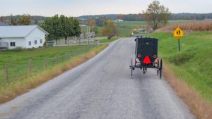
Amish Country Byway (Ohio)
A trip along the 76-mile Amish Country Byway offers a unique look at the culture and lifestyles of the Amish and northern Appalachian people. The byway is divided into three sections: Eastern Section, Millersburg Section and Western Section, with both the eastern and western sections including two loops.
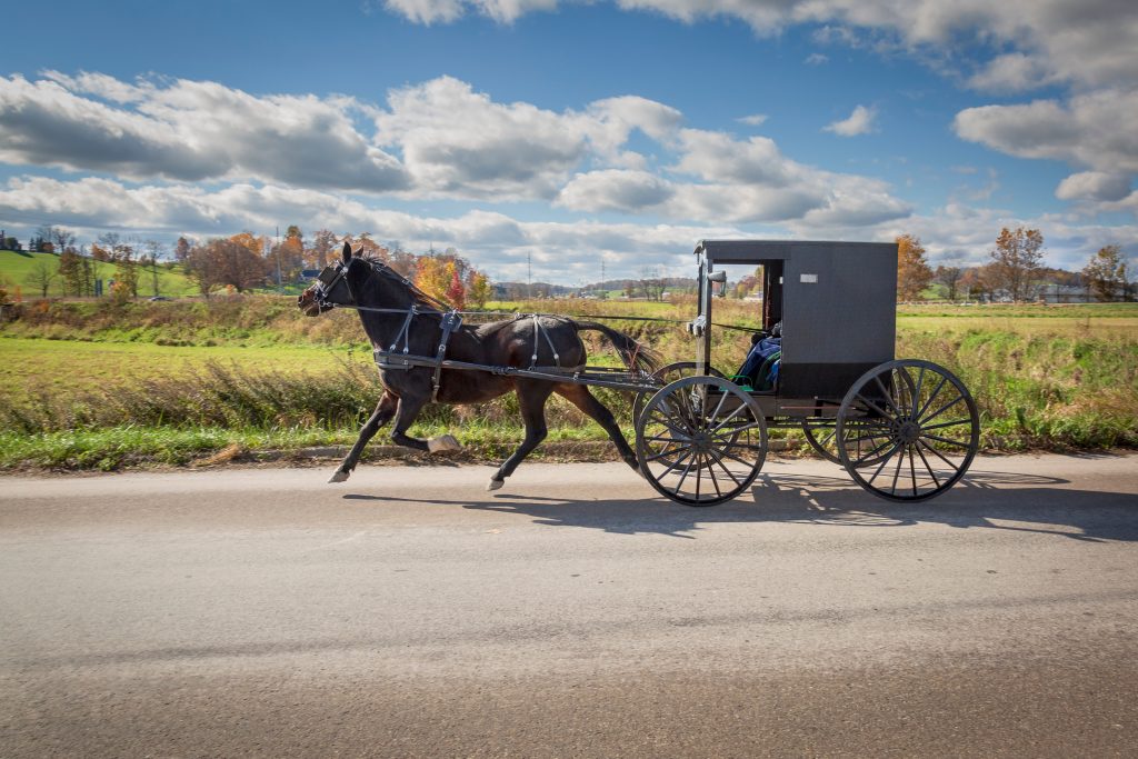
While Amish people use a variety of transportations methods— walking, biking, e-biking and horses—the traditional (and slow-moving) horse-and-buggy will be the one you’ll encounter most often on the roadways. Just pass with caution, especially given the many blind hills and curves in the area. Also, follow Amish-related etiquette.
While there is good cell service throughout Holmes County, there may be dead spots due to the hills and valleys along the route, so be prepared with a county map or the downloadable Amish Country Map & Visitors Guide. (Printed guides are also available.)
In addition to historic sites and sites such as Amish country antique stores and markets, the byway provides the opportunity to enjoy outdoor activities: fishing, hunting, trapping and hiking, as well as water sports such as canoeing, kayaking, rafting, and tubing. Or just relax in a peaceful pastoral setting while dining on delicious Amish cheese and specialty meat products.
Historic National Road (Illinois, Indiana, Maryland, Ohio, Pennsylvania, West Virginia)
The Historic National Road has the distinction of being the nation’s first federally funded interstate highway, linkin six states: Illinois, Indiana, Maryland, Ohio, Pennsylvania and West Virginia. While it began as a way to move people and goods to the west, it’s now a way for visitors to travel back in time by visiting historic locations.
The Ohio portion is nearly 228 miles long with three sections: eastern, middle and western. There are numerous historic, cultural, natural and recreational sites as well as a landscape that ranges from hills and valleys to flat farmland. Fairs and festivals take place in communities along the Historic National Road, such the Drover’s Festival, Jamboree in the Hills, the Ohio Pumpkin Festival, the Reynoldsburg Tomato Festival and the Eaton Pork Festival. The Road also gives you a chance to enjoy the area’s rich craft heritage: art, pottery, basketry and glassmaking. For more about activities along the Historic National Road, download the The Ohio National Road User Guide.
Lake Erie Coastal Ohio Trail (Ohio)
The 293-mile Lake Erie Coastal Ohio Trail offers travelers a chance to experience 12,000 years of history, with maritime museums, restored freighters, lighthouses and other historic sites located along the lake. But if history isn’t your thing, this national scenic byway offers other activities: shopping, fishing, birding, biking, boating, camping, touring and exploring.
The Trail also takes you to major urban locations such as Cleveland and Toledo, along with access to Lake Erie’s islands. For more about the Lake Erie Coastal Ohio Trail, download the Lake Erie Coastal Ohio Trail mobile app and the Lake Erie Scenic Byway Brochure or watch the Lake Erie Coastal Ohio Trail Video.
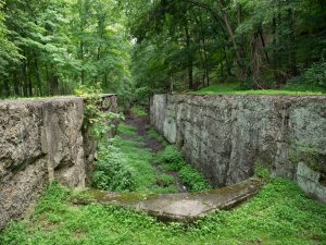
Ohio & Erie Canalway (Ohio)
The 110-mile Ohio & Erie Canalway travels north to south along Ohio’s eastern side, beginning in Cleveland and ending south of New Philadelphia. The Canalway travels alongside the historic path of the Ohio & Erie Canal, the nation’s first inland waterway link between the Great Lakes and the Gulf of Mexico and runs through four counties and 58 communities. It also highlights the range of environments, from industrial communities to farmland, urban locations and nature preserves. The Ohio & Erie Canalway has been designated as both an Ohio State Scenic Byway and an America’s Byway and is also a National Heritage Area.
Ohio River Scenic Byway (Illinois, Indiana, Ohio)
The 943-mile Ohio River Scenic Byway runs along Ohio’s southern border through Indiana until it reaches the conjunction of the Ohio and Mississippi Rivers near Fort Defiance State Park in Illinois. The Byway offers almost continuous views of the river and its 21 locks as well as quaint river communities.
The Ohio portion covers 452 miles, beginning in East Liverpool until it reaches Cincinnati. Along the way, it passes through 13 Appalachian counties full of natural beauty, cultural resources and attractions including festivals, wineries and prehistoric Indian sites. From manufacturing centers to farmlands to exciting major cities, the Ohio section of the Byway provides much to do and see.
Other blogs in this series:
- Take a Scenic Drive Through Maine
- Take a Scenic Drive Through Idaho
- Take a Scenic Drive Through Kansas
- Take a Scenic Drive Through Washington State
- Take a Scenic Drive Through Illinois
Recent Articles
